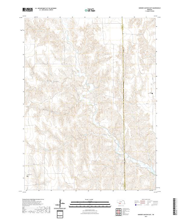
2021 Map of Burger Canyon East
USGS Topo · Published 2021About this map
Burger Canyon and Kucera Canyon dominate this landscape on the border of Hayes and Frontier counties, where the land is deeply carved by drainage systems feeding into Red Willow Cr. This modern 2021 survey by the U.S. Geological Survey illustrates a contemporary rural Nebraska environment defined by its section lines and a sparse network of county roads. The terrain is notably rugged for the plains, characterized by the winding paths of Sand Cr and various unnamed draws. Local history is anchored by two quiet landmarks: Saint Ann's Cem in the northeast and Highland Cem in the southwest, serving as the primary cultural identifiers in this sparsely populated agricultural region.
Find a feature on this map
19 named features on this map. Tap any name to fly to it.
Don’t see what you’re looking for? This feature index may not catch every label — zoom into the map to look around manually.
Map Details
Editions of this 2021 Burger Canyon East Map
This is the sole edition of this map. No revisions or reprints were ever made.
Other maps of this area

1954 · McCook
USGS Topo · 1:250,000

1956 · Curtis SW
USGS Topo · 1:24,000

1957 · McCook
USGS Topo · 1:250,000

1958 · McCook
USGS Topo · 1:250,000

1970 · Red Willow Dam
USGS Topo · 1:24,000

1970 · Quick
USGS Topo · 1:24,000

1970 · Burger Canyon SE
USGS Topo · 1:24,000

1970 · Burger Canyon East
USGS Topo · 1:24,000

1973 · Camp Hayes Lake SE
USGS Topo · 1:24,000
1973 · Beverly
USGS Topo · 1:24,000