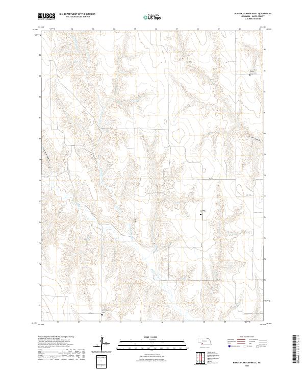
2021 Map of Burger Canyon West
USGS Topo · Published 2021About this map
Blackwood Creek and its tributaries define the rolling landscape of Hayes County in this recent survey. The terrain is marked by deep drainage systems like Government Canyon and Burger Canyon, which carve through the high plains. For the family historian, the map identifies key religious and burial sites that have served this rural community for generations, including the Sacred Heart Catholic Church Cem in the northeast and the German Evangelical Cem to the southwest. The presence of Pleasant Ridge Cem further highlights the early settlement patterns of these upland prairies. Waterways such as Little Blackwood Cr and Skunk Cr are the primary natural features in a region largely dedicated to agriculture and organized by a strict grid of local roads like RD 732 and Ave 370.
Find a feature on this map
16 named features on this map. Tap any name to fly to it.
Don’t see what you’re looking for? This feature index may not catch every label — zoom into the map to look around manually.
Map Details
Editions of this 2021 Burger Canyon West Map
This is the sole edition of this map. No revisions or reprints were ever made.
Other maps of this area

1954 · McCook
USGS Topo · 1:250,000

1957 · McCook
USGS Topo · 1:250,000

1958 · McCook
USGS Topo · 1:250,000

1970 · Burger Canyon SE
USGS Topo · 1:24,000

1970 · Burger Canyon East
USGS Topo · 1:24,000

1973 · Camp Hayes Lake SE
USGS Topo · 1:24,000

1973 · Palisade
USGS Topo · 1:24,000
1973 · Beverly
USGS Topo · 1:24,000
1973 · Burger Canyon West
USGS Topo · 1:24,000

1974 · Hayes Center
USGS Topo · 1:24,000