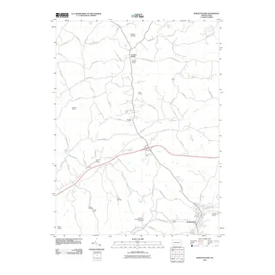
2010 Map of Burgettstown
USGS Topo · Published 2010About this map
Burgettstown and the surrounding rural landscape of Washington County are defined by a network of winding creeks and early industrial sites. The borough itself serves as the southern anchor of this region, with the nearby Francis Mine and The Panhandle Trl marking the legacy of the local coal and rail economy. To the north, the village of Frankfort Springs sits near the edge of Raccoon Creek State Park, while the Frankfort Springs Grange highlights the agricultural heritage of the area.
Find a feature on this map
56 named features on this map. Tap any name to fly to it.
Don’t see what you’re looking for? This feature index may not catch every label — zoom into the map to look around manually.
Map Details
Editions of this 2010 Burgettstown Map
This is the sole edition of this map. No revisions or reprints were ever made.
Other maps of this area

1901 · Beaver
USGS Topo · 1:62,500

1904 · Wellsville
USGS Topo · 1:62,500

1904 · Steubenville
USGS Topo · 1:62,500

1904 · Beaver
USGS Topo · 1:62,500

1904 · Burgettstown
USGS Topo · 1:62,500

1906 · Burgettstown
USGS Topo · 1:62,500

1935 · Steubenville
USGS Topo · 1:62,500

1937 · Wellsville
USGS Topo · 1:62,500

1942 · Steubenville
USGS Topo · 1:62,500

1944 · Wellsville
USGS Topo · 1:62,500
Featured Places
- Burgettstown, PA
- Jefferson Township, PA
- Frankfort Springs, PA
- Dinsmore, Smith Township
- Comettsburg, Hanover Township