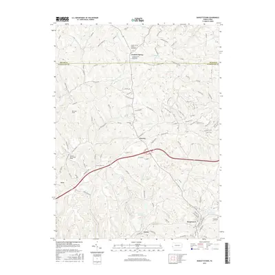
2016 Map of Burgettstown
USGS Topo · Published 2016About this map
Frankfort Springs and the surrounding Washington County hills are depicted here at a time when traditional landmarks and modern infrastructure coexist. The landscape is defined by the winding course of Aunt Clara Fork and Kings Cr, with several notable historic sites for genealogists, including the Frankfort Springs United Presbyterian Church Cem and Chestnut Ridge Cem. A particularly significant landmark is the Jackson's Mill Covered Bridge located along the creek north of Paris.
Find a feature on this map
95 named features on this map. Tap any name to fly to it.
Don’t see what you’re looking for? This feature index may not catch every label — zoom into the map to look around manually.
Map Details
Editions of this 2016 Burgettstown Map
This is the sole edition of this map. No revisions or reprints were ever made.
Other maps of this area

1901 · Beaver
USGS Topo · 1:62,500

1904 · Wellsville
USGS Topo · 1:62,500

1904 · Steubenville
USGS Topo · 1:62,500

1904 · Beaver
USGS Topo · 1:62,500

1904 · Burgettstown
USGS Topo · 1:62,500

1906 · Burgettstown
USGS Topo · 1:62,500

1935 · Steubenville
USGS Topo · 1:62,500

1937 · Wellsville
USGS Topo · 1:62,500

1942 · Steubenville
USGS Topo · 1:62,500

1944 · Wellsville
USGS Topo · 1:62,500
Featured Places
- Burgettstown, PA
- Jefferson Township, PA
- Frankfort Springs, PA
- Dinsmore, Smith Township
- Comettsburg, Hanover Township