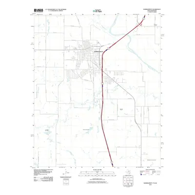
2010 Map of Burkburnett
USGS Topo · Published 2010About this map
The Red River forms the natural northern boundary of this landscape, carving a wide path across the border between Texas and Oklahoma. Centered on the city of Burkburnett, the map documents a region defined by its diverse land use, from the residential grids along Charlotte Ave and S Berry St to the industrial legacy of the Texhoma Oil Field. The southern reaches of the quadrangle are influenced by the proximity of Sheppard Air Force Base, while the central terrain is drained by meandering waterways like Wildhorse Creek and Gilbert Creek. Smaller water bodies, including Crumpler Lake and Preston Lake, are managed by local infrastructure like the Crumpler Lake Dam. Local history researchers will find markers of early settlement and genealogy in the presence of Wilkerson Cemetery and various family-named roads such as Vaughn Rd and J B Riley Rd.
Find a feature on this map
48 named features on this map. Tap any name to fly to it.
Don’t see what you’re looking for? This feature index may not catch every label — zoom into the map to look around manually.
Map Details
Editions of this 2010 Burkburnett Map
This is the sole edition of this map. No revisions or reprints were ever made.
Other maps of this area

1915 · Clara
USGS Topo · 1:24,000

1915 · Burkburnett
USGS Topo · 1:24,000

1916 · Iowa Park
USGS Topo · 1:24,000

1918 · Buckburnett
USGS Topo · 1:31,680

1918 · Clara
USGS Topo · 1:31,680

1918 · Iowa Park
USGS Topo · 1:31,680

1954 · Wichita Falls
USGS Topo · 1:250,000

1955 · Lawton
USGS Topo · 1:250,000

1957 · Wichita Falls West
USGS Topo · 1:24,000

1957 · Burkburnett
USGS Topo · 1:62,500