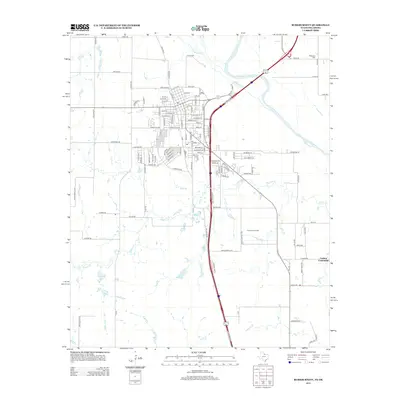
2012 Map of Burkburnett
USGS Topo · Published 2012About this map
The Red River defines the northern boundary of this Texas-Oklahoma borderlands area, where the terrain transitions from the river's edge into the industrial landscape of the Texhoma Oil Field. This survey reveals the infrastructure supporting both the energy sector and the local agricultural economy, characterized by a grid of rural routes such as Thrift Rd and J B Riley Rd. The settlement of Cashion Community anchors the southeast corner of the map, while the Wilkerson Cem serves as a genealogical touchstone for local families. Water features like Preston Lake and Crumpler Lake are situated among the lower reaches of Gilbert Cr, illustrating the hydrological character of the Red River basin before the landscape shifts toward the more densely developed streets of the nearby town center.
Find a feature on this map
117 named features on this map. Tap any name to fly to it.
Don’t see what you’re looking for? This feature index may not catch every label — zoom into the map to look around manually.
Map Details
Editions of this 2012 Burkburnett Map
This is the sole edition of this map. No revisions or reprints were ever made.
Other maps of this area

1915 · Clara
USGS Topo · 1:24,000

1915 · Burkburnett
USGS Topo · 1:24,000

1916 · Iowa Park
USGS Topo · 1:24,000

1918 · Buckburnett
USGS Topo · 1:31,680

1918 · Clara
USGS Topo · 1:31,680

1918 · Iowa Park
USGS Topo · 1:31,680

1954 · Wichita Falls
USGS Topo · 1:250,000

1955 · Lawton
USGS Topo · 1:250,000

1957 · Wichita Falls West
USGS Topo · 1:24,000

1957 · Burkburnett
USGS Topo · 1:62,500