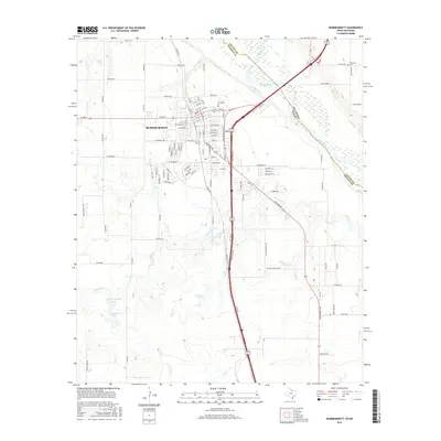
2016 Map of Burkburnett
USGS Topo · Published 2016About this map
Burkburnett serves as a significant hub near the winding border of the Red River, situated just south of the Oklahoma-Texas state line. The landscape is defined by the convergence of several waterways, including the meandering Wildhorse Creek and Gilbert Creek, which drain into the main river valley. Small water bodies like Barbour-Kitchell Lake, Crumpler Lake, and Preston Lake dot the western and central portions of the quadrangle, reflecting the local hydrology of the North Texas plains. To the northeast, the Wilkerson Cemetery marks a quiet landmark near the Cotton County and Wichita County boundary. The area's development is evident in the dense street grid of the city, where routes like Truck Bypass and Sheppard Road facilitate regional transit alongside several established residential corridors.
Find a feature on this map
97 named features on this map. Tap any name to fly to it.
Don’t see what you’re looking for? This feature index may not catch every label — zoom into the map to look around manually.
Map Details
Editions of this 2016 Burkburnett Map
This is the sole edition of this map. No revisions or reprints were ever made.
Other maps of this area

1915 · Clara
USGS Topo · 1:24,000

1915 · Burkburnett
USGS Topo · 1:24,000

1916 · Iowa Park
USGS Topo · 1:24,000

1918 · Buckburnett
USGS Topo · 1:31,680

1918 · Clara
USGS Topo · 1:31,680

1918 · Iowa Park
USGS Topo · 1:31,680

1954 · Wichita Falls
USGS Topo · 1:250,000

1955 · Lawton
USGS Topo · 1:250,000

1957 · Wichita Falls West
USGS Topo · 1:24,000

1957 · Burkburnett
USGS Topo · 1:62,500