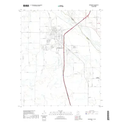
2019 Map of Burkburnett
USGS Topo · Published 2019About this map
The Red River forms the natural boundary between Texas and Oklahoma, anchoring this 2019 survey of the Burkburnett area. This landscape in Wichita County is defined by its hydrology and transportation corridors, where the river's broad channel meets tributaries like Wildhorse Cr and Gilbert Cr. South of the city, the terrain is dotted with substantial water bodies such as Preston Lake and Crumpler Lake, while the Cashion Community sits toward the eastern edge near Bear Cr. For genealogists, the Wilkerson Cem remains a significant landmark near the state line. The map's grid-like street network in the northern section reveals the organized development of the town, transitioning into more sprawling ranch and farm roads like Rifle Range Rd and Reilly Ranch Loop as the elevation shifts toward the southern drainages.
Find a feature on this map
110 named features on this map. Tap any name to fly to it.
Don’t see what you’re looking for? This feature index may not catch every label — zoom into the map to look around manually.
Map Details
Editions of this 2019 Burkburnett Map
This is the sole edition of this map. No revisions or reprints were ever made.
Other maps of this area

1915 · Clara
USGS Topo · 1:24,000

1915 · Burkburnett
USGS Topo · 1:24,000

1916 · Iowa Park
USGS Topo · 1:24,000

1918 · Buckburnett
USGS Topo · 1:31,680

1918 · Clara
USGS Topo · 1:31,680

1918 · Iowa Park
USGS Topo · 1:31,680

1954 · Wichita Falls
USGS Topo · 1:250,000

1955 · Lawton
USGS Topo · 1:250,000

1957 · Wichita Falls West
USGS Topo · 1:24,000

1957 · Burkburnett
USGS Topo · 1:62,500