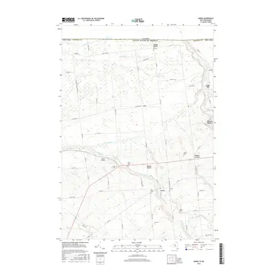
2016 Map of Burke
USGS Topo · Published 2016About this map
The Canada-United States border marks the northern edge of this northern Franklin County landscape, where the town of Burke and its surrounding hamlets sit amidst a network of small waterways. Numerous burial grounds, including Saint George Cem, North Burke Cem, and Pike Cem, are scattered across the terrain, offering significant primary data for genealogical research in this rural pocket of New York. The drainage patterns of the Little Trout River and Chateaugay River define the topography, supporting early local industries like the one at Cooks Mill. From the residential cluster at Burke Center to the small crossroads at Thayer Corners, the map illustrates a well-established grid of local roads and town lines, reflecting a community rooted in its agricultural and waterway-adjacent heritage south of the international boundary.
Find a feature on this map
70 named features on this map. Tap any name to fly to it.
Don’t see what you’re looking for? This feature index may not catch every label — zoom into the map to look around manually.
Map Details
Editions of this 2016 Burke Map
This is the sole edition of this map. No revisions or reprints were ever made.
Other maps of this area

1915 · Chateaugay
USGS Topo · 1:62,500

1915 · Malone
USGS Topo · 1:62,500

1917 · Malone
USGS Topo · 1:62,500

1943 · Chateaugay
USGS Topo · 1:62,500

1948 · Ogdensburg
USGS Topo · 1:250,000

1951 · Ogdensburg
USGS Topo · 1:250,000

1953 · Ogdensburg
USGS Topo · 1:250,000

1961 · Ogdensburg
USGS Topo · 1:250,000
1964 · Chateaugay
USGS Topo · 1:24,000
1964 · Burke
USGS Topo · 1:24,000