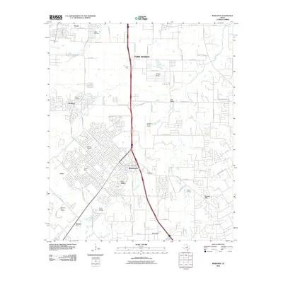
2010 Map of Burleson
USGS Topo · Published 2010About this map
The city of Burleson serves as a central hub on this 2010 topographic record, illustrating the suburban expansion south of Fort Worth along the Interstate 35W corridor. This landscape is characterized by a mix of established neighborhoods, newer residential developments, and aviation infrastructure including Fort Worth Spinks Airport and smaller private strips like Luck Field and Rafter J Airport. These airports, alongside the Redchain Research Farm, highlight the region's specialized land use as it transitioned from open ranch land to a multifaceted metropolitan periphery.
Find a feature on this map
79 named features on this map. Tap any name to fly to it.
Don’t see what you’re looking for? This feature index may not catch every label — zoom into the map to look around manually.
Map Details
Editions of this 2010 Burleson Map
This is the sole edition of this map. No revisions or reprints were ever made.
Other maps of this area

1891 · Cleburne
USGS Topo · 1:125,000

1894 · Cleburne
USGS Topo · 1:125,000

1894 · Fort Worth
USGS Topo · 1:125,000

1954 · Dallas
USGS Topo · 1:250,000

1955 · Burleson
USGS Topo · 1:24,000

1955 · Primrose
USGS Topo · 1:24,000

1955 · Benbrook
USGS Topo · 1:24,000

1955 · Fort Worth
USGS Topo · 1:24,000

1958 · Dallas
USGS Topo · 1:250,000

1959 · Kennedale
USGS Topo · 1:24,000