2022 Map of Burleson
USGS Topo · Published 2022About this map
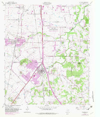
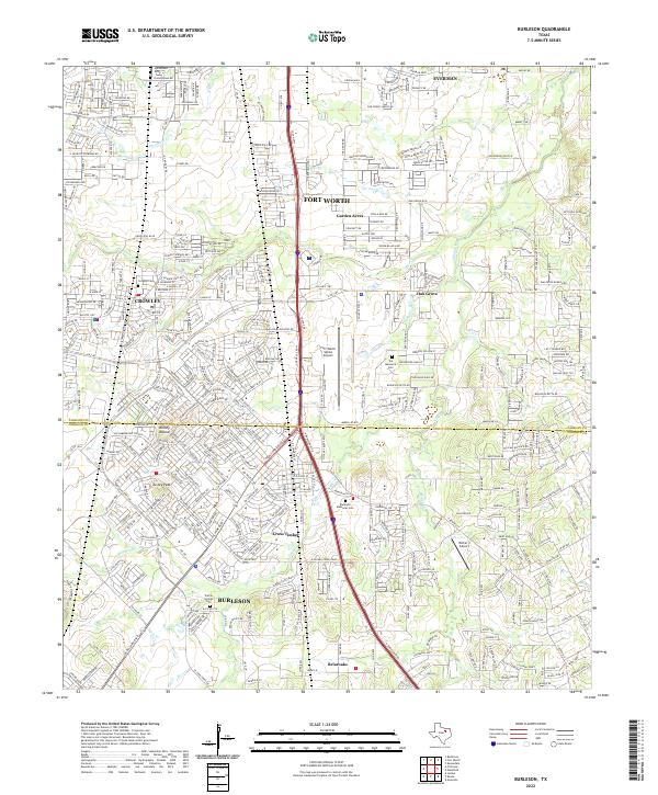
The rolling prairies south of Fort Worth reveal a dense network of suburban development and agricultural transition along the Tarrant and Johnson County line. Modern thoroughfares like the McPherson Expy and Bus Rte 1187 connect the growing centers of Crowley and Burleson, yet the landscape retains many of its original landmarks. Prominent elevations such as Brushy Mound and Turkey Peak rise above the drainage of Village Creek and Deer Creek, providing topographic contrast to the expanding residential grids.
Find a feature on this map
50 named features on this map. Tap any name to fly to it.
Don’t see what you’re looking for? This feature index may not catch every label — zoom into the map to look around manually.
Map Details
Editions of this 2022 Burleson Map
This is the sole edition of this map. No revisions or reprints were ever made.