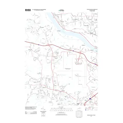
2013 Map of Burlington
USGS Topo · Published 2013About this map
Sayler Park and Taylorsport face each other across the Ohio River, illustrating the enduring importance of this waterway to the suburban and industrial landscape of the tristate area. The map is dominated by the sprawling infrastructure of the Cincinnati/Northern Kentucky International Airport, which serves as a massive transport hub between Hebron and Limaburg. For genealogists, the map is remarkably dense with burial grounds, including the Hebron Lutheran Church-Cem, the Independent Order of Odd Fellows Cem, and the Old Burlington Cem. This mix of early pioneer history and modern logistics is further evidenced by the Boone County Fairgrounds sitting just west of major modern corridors. Recreational spaces like Shorts Woods Golf Course and Boone Links Golf Course suggest the transition from agricultural land to residential development along the river bluffs.
Find a feature on this map
56 named features on this map. Tap any name to fly to it.
Don’t see what you’re looking for? This feature index may not catch every label — zoom into the map to look around manually.
Map Details
Editions of this 2013 Burlington Map
This is the sole edition of this map. No revisions or reprints were ever made.
Other maps of this area

1914 · West Cincinnati
USGS Topo · 1:62,500

1915 · Lawrenceburg
USGS Topo · 1:48,000

1928 · Lawrenceburg
USGS Topo · 1:62,500

1932 · Lawrenceburg
USGS Topo · 1:62,500

1943 · Rising Sun
USGS Topo · 1:24,000

1943 · Hooven
USGS Topo · 1:24,000

1943 · Lawrenceburg
USGS Topo · 1:24,000

1950 · Union
USGS Topo · 1:24,000

1950 · Independence
USGS Topo · 1:24,000

1950 · Covington
USGS Topo · 1:24,000