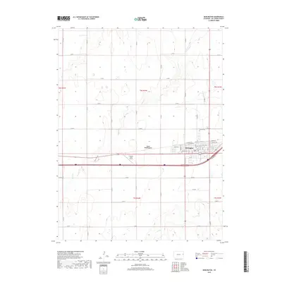
2019 Map of Burlington
USGS Topo · Published 2019About this map
Burlington serves as a significant High Plains hub in this Kit Carson County landscape, where the grid of the city meets the expansive agricultural reaches of eastern Colorado. The map documents a sophisticated network of county roads, such as Co RD 48 and Co RD W, that divide the prairie into distinct sections for farming and ranching. Outside the main town, West Burlington and the Aviation Acres Airport show the continued westward expansion of local infrastructure. To the north, the Fairview Cem remains a notable landmark for those tracing local family history. The terrain is defined by the subtle drainage systems of Beaver Cr, Sand Cr, and Bonny Cr, which provide the essential topographic variation in an otherwise steadily graded plains environment.
Find a feature on this map
52 named features on this map. Tap any name to fly to it.
Don’t see what you’re looking for? This feature index may not catch every label — zoom into the map to look around manually.
Map Details
Editions of this 2019 Burlington Map
This is the sole edition of this map. No revisions or reprints were ever made.
Other maps of this area

1954 · Limon
USGS Topo · 1:250,000

1957 · Limon
USGS Topo · 1:250,000

1958 · Limon
USGS Topo · 1:250,000

1969 · Settlement
USGS Topo · 1:24,000

1969 · Bethune
USGS Topo · 1:24,000

1969 · Burlington
USGS Topo · 1:24,000

1969 · Mount Sunflower NW
USGS Topo · 1:24,000

1969 · Peconic
USGS Topo · 1:24,000

1969 · Kanorado NW
USGS Topo · 1:24,000

1969 · Burlington 3 NW
USGS Topo · 1:24,000