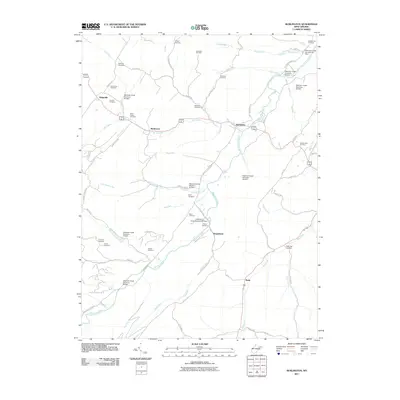
2011 Map of Burlington
USGS Topo · Published 2011About this map
Patterson Creek defines the central corridor of this West Virginia landscape, joined by numerous tributaries including Mill Creek, Sugar Run, and Elliber Run. This area of Mineral County is characterized by a series of engineered water management features, such as Patterson Creek Structure 26 Dam and Patterson Creek Structure 48 Dam, which dot the drainage network. Small crossroads communities like Burlington, Ridgeville, and Markwood are connected by a web of local routes including Knobley Rd and Push Root Rd. Genealogists will find a significant number of family-named burial grounds throughout the valley, from the Rawlings Cemetery in the north to the Elijah High Cemetery in the south, reflecting generations of settlement along the creek banks and ridges like Fried Meat Ridge Rd.
Find a feature on this map
71 named features on this map. Tap any name to fly to it.
Don’t see what you’re looking for? This feature index may not catch every label — zoom into the map to look around manually.
Map Details
Editions of this 2011 Burlington Map
This is the sole edition of this map. No revisions or reprints were ever made.
Other maps of this area

1891 · Romney
USGS Topo · 1:125,000

1895 · Piedmont
USGS Topo · 1:125,000

1919 · Elk Garden
USGS Topo · 1:48,000

1920 · Elk Garden
USGS Topo · 1:48,000

1920 · Moorefield
USGS Topo · 1:62,500

1920 · Keyser
USGS Topo · 1:62,500

1921 · Keyser
USGS Topo · 1:48,000

1921 · Greenland Gap
USGS Topo · 1:62,500

1921 · Moorefield
USGS Topo · 1:48,000

1922 · Elk Garden
USGS Topo · 1:62,500