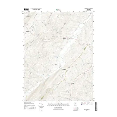
2016 Map of Burlington
USGS Topo · Published 2016About this map
Patterson Creek winds through this West Virginia landscape, cutting a path between the prominent ridges of Knobly Mountain and Patterson Creek Mtn. The 2016 survey illustrates the long-standing agricultural and family-centered character of Mineral and Hampshire counties, where the community of Burlington sits at the junction of US Rte 50 and US Rte 220. Numerous family cemeteries are scattered across the valley floors and hillsides, including the Stone Chapel Cem, Elijah High Cem, and Peerce Cem, reflecting generations of local lineage. The topography is defined by sharp elevation shifts at Fossil Ridge and various springs such as Cave Gap Spring and Anderson Farm Spring. This contemporary update also highlights the modern American Discovery Trail as it traverses the higher ground, connecting this rural region to a larger national network of paths.
Find a feature on this map
86 named features on this map. Tap any name to fly to it.
Don’t see what you’re looking for? This feature index may not catch every label — zoom into the map to look around manually.
Map Details
Editions of this 2016 Burlington Map
This is the sole edition of this map. No revisions or reprints were ever made.
Other maps of this area

1891 · Romney
USGS Topo · 1:125,000

1895 · Piedmont
USGS Topo · 1:125,000

1919 · Elk Garden
USGS Topo · 1:48,000

1920 · Elk Garden
USGS Topo · 1:48,000

1920 · Moorefield
USGS Topo · 1:62,500

1920 · Keyser
USGS Topo · 1:62,500

1921 · Keyser
USGS Topo · 1:48,000

1921 · Greenland Gap
USGS Topo · 1:62,500

1921 · Moorefield
USGS Topo · 1:48,000

1922 · Elk Garden
USGS Topo · 1:62,500