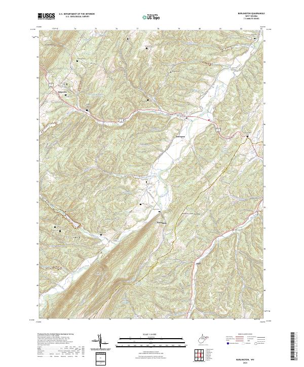
2023 Map of Burlington
USGS Topo · Published 2023About this map
Patterson Creek winds through the heart of this Mineral and Hampshire County landscape, creating a fertile valley corridor between Knobly Mountain and Patterson Creek Mountain. The settlement of Burlington serves as a central hub, where Us Rte 50 and Us Rte 220 converge near the winding waters of Mill Creek. This 2023 survey documents a deeply rooted rural community characterized by numerous family and memorial burial sites, including Leatherman Cem, Elijah High Cem, and Stone Chapel Cem. To the south, Russelldale and Rada sit along the slopes of Fossil Ridge, while smaller landmarks like Manorland Post Motel Spring and the Christian Church illustrate the enduring local geography of this Appalachian region.
Find a feature on this map
102 named features on this map. Tap any name to fly to it.
Don’t see what you’re looking for? This feature index may not catch every label — zoom into the map to look around manually.
Map Details
Editions of this 2023 Burlington Map
This is the sole edition of this map. No revisions or reprints were ever made.
Other maps of this area

1891 · Romney
USGS Topo · 1:125,000

1895 · Piedmont
USGS Topo · 1:125,000

1919 · Elk Garden
USGS Topo · 1:48,000

1920 · Elk Garden
USGS Topo · 1:48,000

1920 · Moorefield
USGS Topo · 1:62,500

1920 · Keyser
USGS Topo · 1:62,500

1921 · Keyser
USGS Topo · 1:48,000

1921 · Greenland Gap
USGS Topo · 1:62,500

1921 · Moorefield
USGS Topo · 1:48,000

1922 · Elk Garden
USGS Topo · 1:62,500