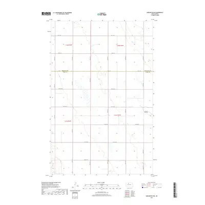
2017 Map of Burlington NW
USGS Topo · Published 2017About this map
Minot Air Force Base occupies a portion of the eastern landscape on this quadrangle at the edge of the Missouri Plateau. This 2017 survey shows the transition between Ward Co and Renville Co, where the land is primarily organized by a rigid grid of rural roads and county routes. The terrain is marked by numerous prairie potholes and seasonal wetlands characteristic of North Dakota's glacial till plains. Egg Cr winds through the northern sections, cutting a modest drainage path through the surrounding fields. The transportation network is defined by regularly spaced corridors such as Co Rd 6 and Co Rd 15 W, which facilitate movement across this agricultural and military-adjacent frontier.
Find a feature on this map
28 named features on this map. Tap any name to fly to it.
Don’t see what you’re looking for? This feature index may not catch every label — zoom into the map to look around manually.
Map Details
Editions of this 2017 Burlington NW Map
This is the sole edition of this map. No revisions or reprints were ever made.
Other maps of this area

1948 · Burlington
USGS Topo · 1:24,000

1948 · Lansford
USGS Topo · 1:62,500

1948 · Burlington
USGS Topo · 1:62,500

1948 · Lansford SW
USGS Topo · 1:24,000

1949 · Burlington NW
USGS Topo · 1:24,000

1949 · Lansford SW
USGS Topo · 1:24,000

1949 · Carpio NE
USGS Topo · 1:24,000

1949 · Grano
USGS Topo · 1:24,000

1949 · Lansford SE
USGS Topo · 1:24,000

1949 · Burlington SE
USGS Topo · 1:24,000