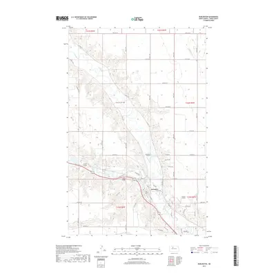
2017 Map of Burlington
USGS Topo · Published 2017About this map
Burlington marks the confluence of two significant waterways in Ward County, where the Des Lacs River joins the winding Souris River. This 2017 survey illustrates a landscape defined by sharp elevation changes along the river valleys, contrasting the flat agricultural uplands with the deeply carved terrain of Lloyds Coulee and Larsons Coulee. The town center of Burlington is framed by these natural watercourses, with the local infrastructure including the Pietschtree Airstrip to the north and Behrens Airstrip to the southeast. The map details a transition from the structured grid of rural roads like 128th Ave NW to the more organic development near the river junction. Small drainage features like Livingston Cr feed into the larger river system, highlighting the area's complex hydrology in the northern plains.
Find a feature on this map
35 named features on this map. Tap any name to fly to it.
Don’t see what you’re looking for? This feature index may not catch every label — zoom into the map to look around manually.
Map Details
Editions of this 2017 Burlington Map
This is the sole edition of this map. No revisions or reprints were ever made.
Other maps of this area

1928 · Minot
USGS Topo · 1:62,500

1948 · Burlington
USGS Topo · 1:24,000

1948 · Burlington
USGS Topo · 1:62,500

1948 · Minot NW
USGS Topo · 1:24,000

1949 · Burlington NW
USGS Topo · 1:24,000

1949 · Minot NW
USGS Topo · 1:24,000

1949 · Carpio NE
USGS Topo · 1:24,000

1949 · Burlington SE
USGS Topo · 1:24,000

1949 · Minot
USGS Topo · 1:24,000
1949 · Burlington NE
USGS Topo · 1:24,000