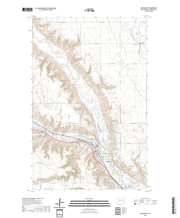
2024 Map of Burlington
USGS Topo · Published 2024About this map
Burlington serves as the focal point of this Ward County landscape, situated at the confluence where the Des Lacs River meets the larger Souris River. This geography creates a complex system of wooded valleys and steep coulees that contrast sharply with the surrounding agricultural tablelands. Local landmarks like Lloyds Coulee and Larsons Coulee demonstrate how water has deeply etched the prairie, while a dense grid of township roads including Co HWY 15 and 114th Ave NW provides access to the higher ground. Genealogists and local historians can find the Burlington Township Cem overlooking the river valley and the Emmanuel Lutheran Cem further north near Livingston Creek. The inclusion of the Pietschtree Airstrip and the developed street plan of Burlington, featuring Colton Ave and Durango St, illustrates the modern character of this river-front community.
Find a feature on this map
54 named features on this map. Tap any name to fly to it.
Don’t see what you’re looking for? This feature index may not catch every label — zoom into the map to look around manually.
Map Details
Editions of this 2024 Burlington Map
This is the sole edition of this map. No revisions or reprints were ever made.
Other maps of this area

1928 · Minot
USGS Topo · 1:62,500

1948 · Burlington
USGS Topo · 1:24,000

1948 · Burlington
USGS Topo · 1:62,500

1948 · Minot NW
USGS Topo · 1:24,000

1949 · Burlington NW
USGS Topo · 1:24,000

1949 · Minot NW
USGS Topo · 1:24,000

1949 · Carpio NE
USGS Topo · 1:24,000

1949 · Burlington SE
USGS Topo · 1:24,000

1949 · Minot
USGS Topo · 1:24,000
1949 · Burlington NE
USGS Topo · 1:24,000