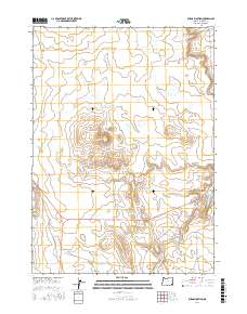
2017 Map of Burns Junction
USGS Topo · Published 2017About this map
Burns Junction sits as a lonely highway crossing in this southeastern Oregon landscape, serving as a vital navigational point where regional routes converge. The terrain is dominated by the prominent elevation of Scott Butte, which rises above a network of seasonal drainage patterns. Waterways such as Scott Butte Cr, Palomino Cr, and Crooked Cr thread through the high desert, illustrating the complex hydrography of Malheur County. The map details the rural road infrastructure including Powell Rd and Crooked Creek Rd, which provide access across the vast sections of the Public Land Survey System, marked here by boundaries like t31s r40e. This survey captures a region defined by its wide-open ranching character and the stark geography of the Oregon outback.
Find a feature on this map
12 named features on this map. Tap any name to fly to it.
Don’t see what you’re looking for? This feature index may not catch every label — zoom into the map to look around manually.
Map Details
Editions of this 2017 Burns Junction Map
This is the sole edition of this map. No revisions or reprints were ever made.
Other maps of this area

1955 · Jordan Valley
USGS Topo · 1:250,000

1957 · Jordan Valley
USGS Topo · 1:250,000

1958 · Jordan Valley
USGS Topo · 1:250,000

1972 · Palomino Hills
USGS Topo · 1:24,000

1972 · Owyhee Butte
USGS Topo · 1:24,000
1972 · Palomino Lake
USGS Topo · 1:24,000

1972 · Rome
USGS Topo · 1:24,000
1972 · Iron Mountain
USGS Topo · 1:24,000
1972 · Burns Junction
USGS Topo · 1:24,000

1979 · Anderson Reservoir
USGS Topo · 1:24,000