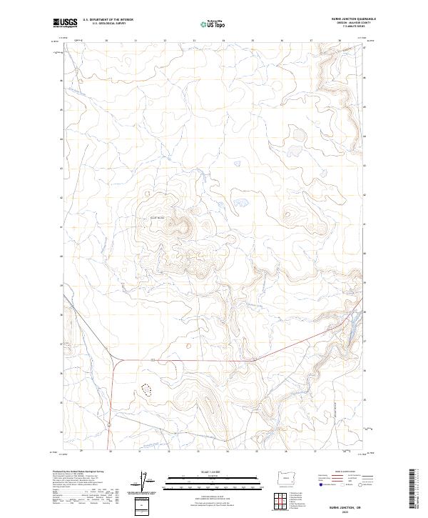
2023 Map of Burns Junction
USGS Topo · Published 2023About this map
Scott Butte rises as a prominent landmark in this corner of Malheur County, defining the high desert drainage patterns of the southeastern Oregon interior. The surrounding landscape is etched by a network of seasonal watercourses and managed water features, including the meandering paths of Scott Butte Creek and Palomino Creek. To the southeast, the terrain transitions toward the drainage of Crooked Creek, where human intervention in the arid environment is evidenced by the Scott Ditch.
Find a feature on this map
12 named features on this map. Tap any name to fly to it.
Don’t see what you’re looking for? This feature index may not catch every label — zoom into the map to look around manually.
Map Details
Editions of this 2023 Burns Junction Map
This is the sole edition of this map. No revisions or reprints were ever made.
Other maps of this area

1955 · Jordan Valley
USGS Topo · 1:250,000

1957 · Jordan Valley
USGS Topo · 1:250,000

1958 · Jordan Valley
USGS Topo · 1:250,000

1972 · Palomino Hills
USGS Topo · 1:24,000

1972 · Owyhee Butte
USGS Topo · 1:24,000
1972 · Palomino Lake
USGS Topo · 1:24,000

1972 · Rome
USGS Topo · 1:24,000
1972 · Iron Mountain
USGS Topo · 1:24,000
1972 · Burns Junction
USGS Topo · 1:24,000

1979 · Anderson Reservoir
USGS Topo · 1:24,000