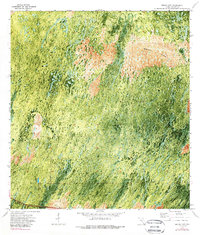
1972 Map of Burns Lake
USGS Topo · Published 1989About this map
Concho stands as a small landmark in this orthophotomap of the Florida Everglades, an area defined by the intricate textures of sawgrass and cypress strands. The southern edge of the sheet is anchored by the vital transportation corridor of the Tamiami Trail and the adjacent Tamiami Canal, which serve as the primary human interventions in an otherwise untamed wetland. To the north, the landscape opens into Windmill Prairie, a distinct terrain feature where the vegetation patterns shift away from the dense hammocks. The 1970s aerial photography reveals the seasonal water patterns and subtle changes in elevation that dictate the location of Burns Road and the small body of Burns Lake. This survey captures the region after the establishment of major crossing routes but before extensive modern environmental restoration efforts in the Big Cypress area.
Find a feature on this map
6 named features on this map. Tap any name to fly to it.
Don’t see what you’re looking for? This feature index may not catch every label — zoom into the map to look around manually.
Map Details
Editions of this 1972 Burns Lake Map
2 editions found
Other maps of this area

1956 · Miami
USGS Topo · 1:250,000

1956 · West Palm Beach
USGS Topo · 1:250,000

1957 · West Palm Beach
USGS Topo · 1:250,000

1958 · West Palm Beach
USGS Topo · 1:250,000

1958 · Miami
USGS Topo · 1:250,000

1959 · Deep Lake
USGS Topo · 1:24,000

1972 · Monroe Station NE
USGS Topo · 1:24,000

1972 · Burns Lake
USGS Topo · 1:24,000

1972 · Ochopee
USGS Topo · 1:24,000

1973 · Gator Hook Swamp
USGS Topo · 1:24,000