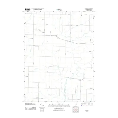
2012 Map of Burnside
USGS Topo · Published 2012About this map
The La Moine River and its numerous tributaries, including Spring Cr and Wildcat Cr, define the drainage patterns of this eastern Hancock County landscape. Small agricultural settlements like Burnside and Durham are connected by a rigid grid of section-line roads, such as Co RD-2800 and Co RD-2100, which reflect the enduring legacy of the Public Land Survey System in the Illinois prairie. For genealogists, the map identifies local burial sites such as Durham Cem and Vandruff Cem, providing essential points of reference for family history research. The transition from the flat uplands to the winding creek beds of Deer Cr and Grove Cr illustrates the relationship between the productive till plains and the natural waterways that served as the primary landmarks for early settlers in the region.
Find a feature on this map
37 named features on this map. Tap any name to fly to it.
Don’t see what you’re looking for? This feature index may not catch every label — zoom into the map to look around manually.
Map Details
Editions of this 2012 Burnside Map
This is the sole edition of this map. No revisions or reprints were ever made.
Other maps of this area

1913 · Colchester
USGS Topo · 1:62,500

1918 · La Harpe
USGS Topo · 1:62,500

1932 · Lomax
USGS Topo · 1:62,500

1933 · Carthage
USGS Topo · 1:62,500

1937 · Carthage
USGS Topo · 1:62,500

1937 · Lomax
USGS Topo · 1:62,500

1958 · Burlington
USGS Topo · 1:250,000

1961 · Burlington
USGS Topo · 1:250,000

1963 · Burlington
USGS Topo · 1:250,000

1964 · Lomax
USGS Topo · 1:24,000