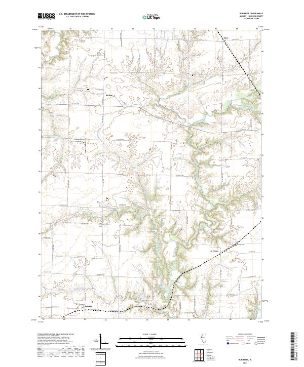
2024 Map of Burnside
USGS Topo · Published 2024About this map
Burnside and the surrounding agricultural uplands of Hancock County are defined by a network of dendritic stream valleys that feed into the La Moine River. This 2024 survey illustrates the persistent rural character of the region, where small unincorporated settlements like Durham and La Crosse remain anchored by a grid of county roads. The landscape is deeply carved by water, with Grove Creek and Deer Creek creating significant relief against the flat till plain, a topography that likely influenced early cemetery placement and land use.
Find a feature on this map
50 named features on this map. Tap any name to fly to it.
Don’t see what you’re looking for? This feature index may not catch every label — zoom into the map to look around manually.
Map Details
Editions of this 2024 Burnside Map
This is the sole edition of this map. No revisions or reprints were ever made.
Other maps of this area

1913 · Colchester
USGS Topo · 1:62,500

1918 · La Harpe
USGS Topo · 1:62,500

1932 · Lomax
USGS Topo · 1:62,500

1933 · Carthage
USGS Topo · 1:62,500

1937 · Carthage
USGS Topo · 1:62,500

1937 · Lomax
USGS Topo · 1:62,500

1958 · Burlington
USGS Topo · 1:250,000

1961 · Burlington
USGS Topo · 1:250,000

1963 · Burlington
USGS Topo · 1:250,000

1964 · Lomax
USGS Topo · 1:24,000