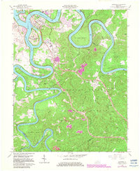
1965 Map of Burnside
USGS Topo · Published 1983About this map
General Burnside Island State Park sits at the confluence of the Cumberland River and its South Fork, surrounded by the rising waters of Lake Cumberland. This mid-century survey, with early 1980s updates, documents the dramatic hydraulic landscape of southern Pulaski County, where deep river bends like Woodson Bend and Antioch Bend dominate the topography. The industrial and transportation history of the region is evident in the path of the Southern Railroad and the remnants of the Old Martin Railroad. Local life centers on rural crossroads and ridge-top settlements such as Tateville, Sloans Valley, and Bronston. Within the Daniel Boone National Forest, the map records distinctive cultural markers including the Charcoal Ovens near the McCreary County line and the Lookout Tower on a high ridge, alongside several country churches like Grave Hill Ch and the combined Piney Grove Ch and Sch.
Find a feature on this map
53 named features on this map. Tap any name to fly to it.
Don’t see what you’re looking for? This feature index may not catch every label — zoom into the map to look around manually.
Map Details
Editions of this 1965 Burnside Map
3 editions found
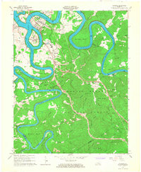
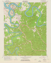
Other maps of this area

1890 · Williamsburg
USGS Topo · 1:125,000

1893 · London
USGS Topo · 1:125,000

1894 · Williamsburg
USGS Topo · 1:125,000

1897 · London
USGS Topo · 1:125,000

1932 · Burnside
USGS Topo · 1:62,500

1935 · Somerset
USGS Topo · 1:62,500

1952 · Hail
USGS Topo · 1:24,000

1952 · Wiborg
USGS Topo · 1:24,000

1952 · Dykes
USGS Topo · 1:24,000

1953 · Frazer
USGS Topo · 1:24,000