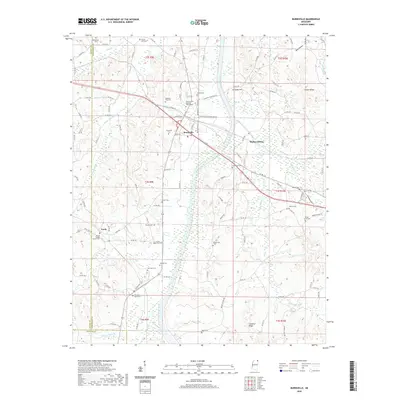
2020 Map of Burnsville
USGS Topo · Published 2020About this map
Burnsville stands as a central crossroads in northeast Mississippi, where the Norfolk Southern railroad tracks intersect with a landscape defined by the winding course of Yellow Creek. This terrain is notable for its dense concentration of family and community burial grounds, illustrating the deep genealogical roots of Tishomingo County. From Opossum Trot Cem in the north to the Sardis Cem near the Prentiss County line, these sites mark the enduring heritage of rural settlements like Leedy and Walker Siding. The physical geography is dominated by ridges and hollows, including Chestnut Ridge and the heights of Woodall Mtn, which overlook a network of small waterways such as Little Yellow Cr and Blasingame Cr. The placement of Harmony Hill Baptist Church/Cem and Christ Gospel Church Cem suggests a community structure long anchored by its religious institutions and local roadways.
Find a feature on this map
128 named features on this map. Tap any name to fly to it.
Don’t see what you’re looking for? This feature index may not catch every label — zoom into the map to look around manually.
Map Details
Editions of this 2020 Burnsville Map
This is the sole edition of this map. No revisions or reprints were ever made.
Other maps of this area

1911 · Iuka
USGS Topo · 1:48,000

1914 · Iuka
USGS Topo · 1:62,500

1935 · Holcut
USGS Topo · 1:24,000

1935 · Doskie
USGS Topo · 1:24,000

1935 · Iuka
USGS Topo · 1:24,000

1935 · Leedy
USGS Topo · 1:24,000

1935 · Glens
USGS Topo · 1:24,000

1936 · Kendrick
USGS Topo · 1:24,000

1936 · Shaws
USGS Topo · 1:24,000

1936 · Tishomingo
USGS Topo · 1:24,000