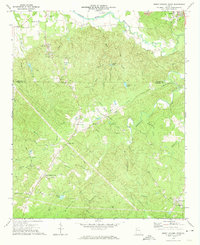
1972 Map of Burnt Hickory Ridge
USGS Topo · Published 1974About this map
The Etowah Indian Mounds occupy a prominent bend in the Etowah River at the northern edge of this Paulding and Bartow County landscape. This 1970s record illustrates a transition between the established industrial outskirts of Emerson and the rural network of ridges and family churches that define the southern portion of the sheet. The terrain is marked by the winding courses of Pumpkinvine Creek and its many tributaries, such as Gourd Br and Spring Br, which carved the valleys that dictated early road placement.
Find a feature on this map
53 named features on this map. Tap any name to fly to it.
Don’t see what you’re looking for? This feature index may not catch every label — zoom into the map to look around manually.
Map Details
Editions of this 1972 Burnt Hickory Ridge Map
2 editions found
Other maps of this area

1890 · Cartersville
USGS Topo · 1:125,000

1891 · Marietta
USGS Topo · 1:125,000

1891 · Cartersville
USGS Topo · 1:125,000

1895 · Marietta
USGS Topo · 1:125,000

1896 · Cartersville
USGS Topo · 1:125,000

1897 · Marietta
USGS Topo · 1:125,000

1901 · Marietta
USGS Topo · 1:125,000

1906 · Stilesboro
USGS Topo · 1:62,500

1907 · Acworth
USGS Topo · 1:62,500

1908 · Stilesboro
USGS Topo · 1:62,500