
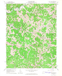
1964 Map of Burnt House
USGS Topo · Published 1978About this map
Oil wells pepper the dissected plateaus of West Virginia in the mid-1960s, reflecting the deep-rooted extraction history of the Ritchie and Gilmer county line. The small settlement of Burnt House serves as a local hub along the Grass Run valley, where many of the area's primary roads converge. This era shows a landscape where religious and civic life centered on rural hilltops and hollows, evidenced by the numerous country churches and cemeteries like Smith Chapel, Roseville Ch, and the New Mt Olive Church.
Find a feature on this map
73 named features on this map. Tap any name to fly to it.
Don’t see what you’re looking for? This feature index may not catch every label — zoom into the map to look around manually.
Map Details
Editions of this 1964 Burnt House Map
3 editions found
Other maps of this area

1893 · Sutton
USGS Topo · 1:125,000

1906 · Holbrook
USGS Topo · 1:62,500

1906 · Glenville
USGS Topo · 1:62,500

1907 · Harrisville
USGS Topo · 1:62,500

1907 · Arnoldsburg
USGS Topo · 1:62,500

1924 · Harrisville
USGS Topo · 1:62,500

1924 · Holbrook
USGS Topo · 1:62,500

1925 · Glenville
USGS Topo · 1:62,500

1925 · Arnoldsburg
USGS Topo · 1:62,500

1926 · Harrisville
USGS Topo · 1:62,500