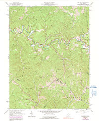
1964 Map of Macfarlan
USGS Topo · Published 1991About this map
South Fork Hughes River snakes through the deep valleys of the Murphy and Sheridan districts, defining the rural character of this West Virginia landscape in the early 1960s. The region is heavily marked by the Oil Field industry, with numerous Oil Wells scattered across the ridgelines of Pleasant Ridge and the Burning Springs territory. These industrial markers sit alongside signs of established community life, including several small country churches such as Nutter Chapel and Bell Chapel.
Find a feature on this map
48 named features on this map. Tap any name to fly to it.
Don’t see what you’re looking for? This feature index may not catch every label — zoom into the map to look around manually.
Map Details
Editions of this 1964 Macfarlan Map
3 editions found
Other maps of this area

1906 · Elizabeth
USGS Topo · 1:62,500

1907 · Harrisville
USGS Topo · 1:62,500

1907 · Arnoldsburg
USGS Topo · 1:62,500

1907 · Spencer
USGS Topo · 1:62,500

1924 · Harrisville
USGS Topo · 1:62,500

1924 · Elizabeth
USGS Topo · 1:62,500

1925 · Arnoldsburg
USGS Topo · 1:62,500

1926 · Elizabeth
USGS Topo · 1:62,500

1926 · Harrisville
USGS Topo · 1:62,500

1927 · Arnoldsburg
USGS Topo · 1:62,500