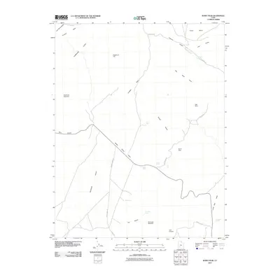
2010 Map of Burnt Peak
USGS Topo · Published 2010About this map
The Hurricane Cliffs dominate the northwestern corner of this high-desert landscape, where the dramatic elevation change transitions into the broad expanse of Sagebrush Flat. This 2010 survey of Iron County highlights a region defined by its complex drainage network and isolated peaks. Water is the primary sculptor here, with Middle Spring Wash cutting a diagonal path across the center, supported by numerous smaller features like North Spring, Robb Spring, and Middle Spring. To the east, the topography rises toward Burnt Peak and Showalter Mountain. The road network is sparse, centered on the historic Freemont Rd and North Swell Rd, reflecting a landscape utilized for livestock grazing and land management rather than dense settlement. The presence of Big Swamp Springs and Cox Springs in the eastern valleys suggests critical water sources in an otherwise arid basin.
Find a feature on this map
32 named features on this map. Tap any name to fly to it.
Don’t see what you’re looking for? This feature index may not catch every label — zoom into the map to look around manually.
Map Details
Editions of this 2010 Burnt Peak Map
This is the sole edition of this map. No revisions or reprints were ever made.
Other maps of this area

1885 · Beaver
USGS Topo · 1:250,000

1886 · Kanab
USGS Topo · 1:250,000

1953 · Richfield
USGS Topo · 1:250,000

1953 · Cedar City
USGS Topo · 1:250,000

1958 · Richfield
USGS Topo · 1:250,000

1958 · Cedar City
USGS Topo · 1:250,000

1962 · Cedar City
USGS Topo · 1:250,000

1966 · Fremont Pass
USGS Topo · 1:24,000

1966 · Panguitch NW
USGS Topo · 1:24,000

1971 · Buckhorn Flat
USGS Topo · 1:24,000