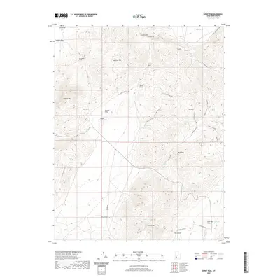
2020 Map of Burnt Peak
USGS Topo · Published 2020About this map
Burnt Peak and Showalter Mtn anchor this high-elevation landscape in Iron County, where the topography is defined by the sharp transition of the Hurricane Cliffs. The area serves as a significant drainage basin, with numerous seasonal water sources such as Robb Spring, Big Swamp Springs, and North Spring feeding into washes like Lees Spring Wash. The human footprint is visible through a network of specialized access roads, including Sackett Hollow and the Buckskin Power Line Rd, which navigate the complex terrain of Buckskin Valley and Oak Basin. This modern survey details the intricate relationship between high mountain peaks and the broad, flat reaches of Sagebrush Flat, providing a clear record of the region's geographic features and remote infrastructure.
Find a feature on this map
39 named features on this map. Tap any name to fly to it.
Don’t see what you’re looking for? This feature index may not catch every label — zoom into the map to look around manually.
Map Details
Editions of this 2020 Burnt Peak Map
This is the sole edition of this map. No revisions or reprints were ever made.
Other maps of this area

1885 · Beaver
USGS Topo · 1:250,000

1886 · Kanab
USGS Topo · 1:250,000

1953 · Richfield
USGS Topo · 1:250,000

1953 · Cedar City
USGS Topo · 1:250,000

1958 · Richfield
USGS Topo · 1:250,000

1958 · Cedar City
USGS Topo · 1:250,000

1962 · Cedar City
USGS Topo · 1:250,000

1966 · Fremont Pass
USGS Topo · 1:24,000

1966 · Panguitch NW
USGS Topo · 1:24,000

1971 · Buckhorn Flat
USGS Topo · 1:24,000