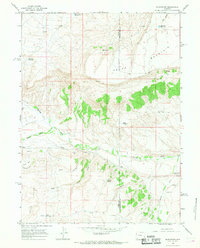
1964 Map of Burntfork
USGS Topo · Published 1968About this map
Burntfork sits at the base of the Cedar Mountain plateau, where the convergence of Henrys Fork and Burnt Fork dictates the settlement pattern and agricultural infrastructure of the mid-1960s. The landscape is defined by the vital management of water, evidenced by a network of diversions including the Nielsen Ditch and the Cedar Basin Ditch, which channel resources from the surrounding highlands. This arid Uinta County environment features numerous isolated water sources like Nielsen Spring and Webb Spring, which were critical to ranching operations in the shadow of the Bald Range. Genealogists and local historians can locate specific family-associated sites such as the Stewart Cem and another cemetery near the creek, along with early infrastructure like the Slide Reservoir and various reservoirs named for local settlers, including Behunin Reservoir and Hussman Reservoir.
Find a feature on this map
29 named features on this map. Tap any name to fly to it.
Don’t see what you’re looking for? This feature index may not catch every label — zoom into the map to look around manually.
Map Details
Editions of this 1964 Burntfork Map
2 editions found
Other maps of this area

1885 · Ashley
USGS Topo · 1:250,000

1885 · Uinta
USGS Topo · 1:250,000

1905 · Gilbert Peak
USGS Topo · 1:125,000

1906 · Gilbert Peak
USGS Topo · 1:125,000

1906 · Marsh Peak
USGS Topo · 1:125,000

1908 · Marsh Peak
USGS Topo · 1:125,000

1954 · Salt Lake City
USGS Topo · 1:250,000

1954 · Vernal
USGS Topo · 1:250,000

1954 · Ogden
USGS Topo · 1:250,000

1954 · Rock Springs
USGS Topo · 1:250,000