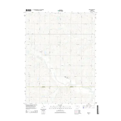
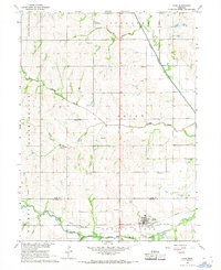
2014 Map of Burr
USGS Topo · Published 2014About this map
The village of Burr anchors this agricultural landscape in Otoe County, situated just north of the Otoe and Johnson county line. The terrain is defined by the winding course of the S Fork Little Nemaha River and its numerous tributaries, including Saunders Cr and Pettis Br. This drainage network created a rolling topography that shaped the rectilinear grid of local roads, such as Co Road R and Railway St, which connect the small settlement to the surrounding farmsteads. For those researching local family history, the map identifies specific burial grounds like Dughman Cem and Hope Cem, providing essential points of reference for genealogical study. The presence of NE-66E-Spur indicates the continued importance of regional highway connectivity for this rural Nebraska community.
Find a feature on this map
39 named features on this map. Tap any name to fly to it.
Don’t see what you’re looking for? This feature index may not catch every label — zoom into the map to look around manually.
Map Details
Editions of this 2014 Burr Map
This is the sole edition of this map. No revisions or reprints were ever made.
Other maps of this area

1903 · Weeping Water
USGS Topo · 1:125,000

1929 · Weeping Water
USGS Topo · 1:125,000

1955 · Lincoln
USGS Topo · 1:250,000

1957 · Lincoln
USGS Topo · 1:250,000

1958 · Lincoln
USGS Topo · 1:250,000

1965 · Sterling
USGS Topo · 1:24,000
1965 · Douglas
USGS Topo · 1:24,000
1965 · Tecumseh NW
USGS Topo · 1:24,000
1965 · St. Mary
USGS Topo · 1:24,000
1966 · Cook
USGS Topo · 1:24,000