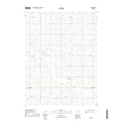
2017 Map of Burr
USGS Topo · Published 2017About this map
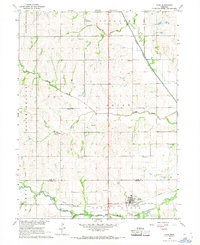
The village of Burr sits at a low point near the center of this rural landscape, defined by the winding course of the S Fork Little Nemaha River as it moves toward the county line. This 2017 survey reveals the intricate network of section-line roads and creek systems that have shaped the agricultural development of western Otoe County. Notable for genealogists, the map identifies local burial grounds including Dughman Cem and Hope Cem, both situated on slightly higher ground overlooking the surrounding drainages. The local hydrology is a prominent feature, with several named tributaries like Little Muddy Cr, Saunders Cr, and Pratt Br carving through the prairie. The settlement pattern remains centered on the small grid of Burr, where Railway St serves as a reminder of the corridor's historic transportation links near the Otoe and Johnson County boundary.
Find a feature on this map
48 named features on this map. Tap any name to fly to it.
Don’t see what you’re looking for? This feature index may not catch every label — zoom into the map to look around manually.
Map Details
Editions of this 2017 Burr Map
This is the sole edition of this map. No revisions or reprints were ever made.
Other maps of this area

1903 · Weeping Water
USGS Topo · 1:125,000

1929 · Weeping Water
USGS Topo · 1:125,000

1955 · Lincoln
USGS Topo · 1:250,000

1957 · Lincoln
USGS Topo · 1:250,000

1958 · Lincoln
USGS Topo · 1:250,000

1965 · Sterling
USGS Topo · 1:24,000
1965 · Douglas
USGS Topo · 1:24,000
1965 · Tecumseh NW
USGS Topo · 1:24,000
1965 · St. Mary
USGS Topo · 1:24,000
1966 · Cook
USGS Topo · 1:24,000