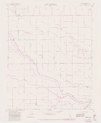
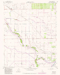
1954 Map of Burrel
USGS Topo · Published 1982About this map
Burrel and Lanare anchor this Central Valley landscape, where an intricate network of irrigation ditches and sloughs defines the agricultural and industrial character of the mid-20th century. The territory is dominated by water management and energy extraction, featuring the Helm Oil Field and Riverdale Oil Field. Water control is evidenced by structures such as the Stinson Weir and Crescent Weir, which manage the flow of the N Fk Kings River and the complex Fresno Slough system. To the south, the presence of the Lemoore Naval Air Station marks a significant military footprint near the Fresno and Kings County line. The Southern Pacific railroad runs through the northern section, connecting the small settlement of Burrel to the broader regional economy. The map illustrates a transitional period where traditional ranching and farming lands like Laguna De Tache were increasingly integrated into industrial-scale oil production and military aviation.
Find a feature on this map
45 named features on this map. Tap any name to fly to it.
Don’t see what you’re looking for? This feature index may not catch every label — zoom into the map to look around manually.
Map Details
Editions of this 1954 Burrel Map
5 editions found
Other maps of this area

1912 · Coalinga
USGS Topo · 1:125,000

1924 · Riverdale
USGS Topo · 1:31,680

1925 · Helm
USGS Topo · 1:31,680

1925 · Raisin
USGS Topo · 1:31,680

1925 · Caruthers
USGS Topo · 1:31,680

1926 · Lethent
USGS Topo · 1:31,680

1927 · Burrel
USGS Topo · 1:31,680

1927 · Riverdale
USGS Topo · 1:31,680

1927 · Lemoore
USGS Topo · 1:31,680

1931 · Wheatville
USGS Topo · 1:31,680