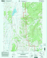
2001 Map of Burrville
USGS Topo · Published 2003About this map
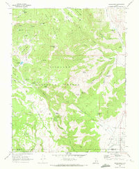
Burrville sits at the western edge of this High Plateaus landscape, where the irrigated fields of Grass Valley meet the rising elevations of the Fishlake National Forest. The geography is defined by a series of dramatic transitions, from the Koosharem Reservoir in the north to the sprawling Praetor Slopes that climb toward the Fish Lake Hightop Plateau. This 2001 revision illustrates the managed water systems essential to the region, including the Canal and Otter Creek, which supported the early agricultural settlement at the foot of Burr Creek.
Find a feature on this map
48 named features on this map. Tap any name to fly to it.
Don’t see what you’re looking for? This feature index may not catch every label — zoom into the map to look around manually.
Map Details
Editions of this 2001 Burrville Map
This is the sole edition of this map. No revisions or reprints were ever made.
Other maps of this area

1885 · Fish Lake
USGS Topo · 1:250,000

1896 · Fish Lake
USGS Topo · 1:250,000

1956 · Salina
USGS Topo · 1:250,000

1960 · Salina
USGS Topo · 1:250,000

1962 · Salina
USGS Topo · 1:250,000

1968 · Fish Lake
USGS Topo · 1:24,000
1968 · Water Creek Canyon
USGS Topo · 1:24,000
1968 · Boobe Hole Reservoir
USGS Topo · 1:24,000
1968 · Mt Terrill
USGS Topo · 1:24,000
1968 · Koosharem
USGS Topo · 1:24,000