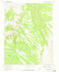
1968 Map of Water Creek Canyon
USGS Topo · Published 1972About this map
Fishlake National Forest encompasses the vast majority of this high-altitude landscape in Sevier County, where a complex network of pack trails and jeep trails provides access to a series of remote water resources. The terrain is defined by dramatic elevation changes between Water Creek Canyon and the surrounding heights of Squeedunk Ridge and Bell Rock Ridge. Strategic water management is evident throughout the survey, with several named impoundments such as Annabella Reservoir, Davis Hollow Reservoir, and Bear Valley Res situated across the mountain flats. Local history and ranching roots are preserved through family-named landmarks like Christensen Spring, Killian Spring, and Brimhall Springs, while the lower reaches of Peterson Creek and Water Creek flow through canyons named for their distinctive timber and geology, including Lone Pine Canyon and Bell Rock Canyon.
Find a feature on this map
44 named features on this map. Tap any name to fly to it.
Don’t see what you’re looking for? This feature index may not catch every label — zoom into the map to look around manually.
Map Details
Editions of this 1968 Water Creek Canyon Map
2 editions found
Other maps of this area

1885 · Beaver
USGS Topo · 1:250,000

1885 · Fish Lake
USGS Topo · 1:250,000

1896 · Fish Lake
USGS Topo · 1:250,000

1940 · Monroe
USGS Topo · 1:62,500

1944 · Monroe
USGS Topo · 1:62,500

1953 · Richfield
USGS Topo · 1:250,000

1956 · Salina
USGS Topo · 1:250,000

1958 · Richfield
USGS Topo · 1:250,000

1960 · Salina
USGS Topo · 1:250,000

1961 · Richfield
USGS Topo · 1:62,500