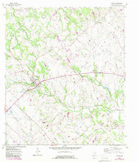
1958 Map of Burton
USGS Topo · Published 1989About this map
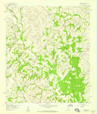
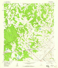
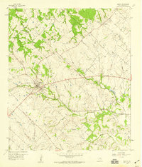
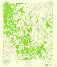
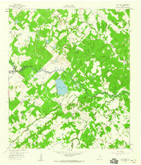
Burton stands as the central hub of this landscape at the border of Washington and Austin counties, showing a clustered settlement pattern defined by its road and rail connections. The map reveals a deeply personal geography marked by family and community landmarks, such as Hall Cem and Broesche Cem, which suggest the long-standing agricultural roots of the area's early residents. The terrain is intricately dissected by a network of waterways, including Mayfield Creek, Indian Creek, and the East Fork, creating a rolling topography that shaped the placement of rural outposts like Union Hill and Longpoint. North of the main townsite, St Paul Ch serves as a northern anchor for the rural population. Industrial activity is localized at the Gravel Pits near Sheppard Creek, while Artesian Park provides a notable point of interest along the eastern drainage of Mill Creek.
Find a feature on this map
32 named features on this map. Tap any name to fly to it.
Don’t see what you’re looking for? This feature index may not catch every label — zoom into the map to look around manually.
Map Details
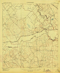
Editions of this 1958 Burton Map
2 editions found
Other maps of this area
1914 · Gay Hill
USGS Topo · 1:62,500
1930 · Brenham
USGS Topo · 1:62,500

1954 · Austin
USGS Topo · 1:250,000
1956 · Brenham
USGS Topo · 1:62,500
1956 · Somerville
USGS Topo · 1:62,500
1958 · Greenvine
USGS Topo · 1:24,000
1958 · Carmine
USGS Topo · 1:24,000
1958 · Burton
USGS Topo · 1:24,000
1958 · Round Top
USGS Topo · 1:24,000
1959 · Flag Pond
USGS Topo · 1:24,000