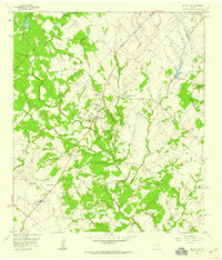
1958 Map of Round Top
USGS Topo · Published 1959About this map
Round Top and the surrounding Fayette County countryside are defined by a network of family-named cemeteries and rural congregations in the late 1950s. The settlement pattern reveals the deep German and Anglo-American roots of the region, anchored by landmarks such as Bethlehem Ch and the Cornerville Primitive Ch. The landscape is heavily dissected by the tributaries of Cummins Creek, including Jacks Creek and Rocky Creek, which dictated the winding paths of local thoroughfares like Town Rdy.
Find a feature on this map
34 named features on this map. Tap any name to fly to it.
Don’t see what you’re looking for? This feature index may not catch every label — zoom into the map to look around manually.
Map Details
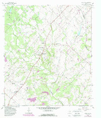
Editions of this 1958 Round Top Map
2 editions found
Other maps of this area

1919 · Fayettsville
USGS Topo · 1:62,500

1919 · Giddings
USGS Topo · 1:62,500

1953 · Seguin
USGS Topo · 1:250,000

1954 · Austin
USGS Topo · 1:250,000

1956 · La Grange
USGS Topo · 1:62,500

1957 · La Grange East
USGS Topo · 1:24,000

1958 · Seguin
USGS Topo · 1:250,000

1958 · Industry
USGS Topo · 1:24,000

1958 · Ledbetter
USGS Topo · 1:24,000

1958 · Greenvine
USGS Topo · 1:24,000