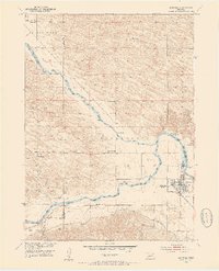
1952 Map of Burwell
USGS Topo · Published 1954About this map
The town of Burwell serves as the focal point of this mid-century survey, situated at the confluence of the Calamus River and the North Loup River. The landscape is defined by the early development of the Missouri River Basin project, featuring the North Loup Dam and an intricate system of water management including the Taylor Ord Canal and a specialized siphon structure. The transportation network is anchored by the Chicago Burlington and Quincy RR, which supports the region's agricultural economy.
Find a feature on this map
33 named features on this map. Tap any name to fly to it.
Don’t see what you’re looking for? This feature index may not catch every label — zoom into the map to look around manually.
Map Details
Editions of this 1952 Burwell Map
2 editions found
Other maps of this area

1952 · Burwell
USGS Topo · 1:24,000

1952 · Sargent East
USGS Topo · 1:24,000

1952 · Elyria
USGS Topo · 1:24,000

1952 · Burwell SE
USGS Topo · 1:24,000

1952 · Burwell NE
USGS Topo · 1:24,000

1952 · Taylor SE
USGS Topo · 1:24,000

1952 · Comstock NW
USGS Topo · 1:24,000

1952 · Burwell NW
USGS Topo · 1:24,000

1952 · Taylor NE
USGS Topo · 1:24,000

1955 · Broken Bow
USGS Topo · 1:250,000