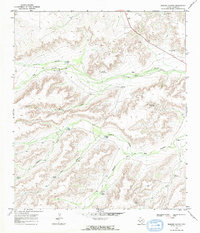
1968 Map of Busher Canyon
USGS Topo · Published 1971About this map
Water management infrastructure defines this arid section of Pecos County, where a network of windmills and tanks supports ranching operations across a complex system of draws and canyons. In this late 1960s landscape, family and place-named features like New Busher Windmill and Rebecca Windmill serve as vital landmarks for navigation and land use. The terrain is deeply incised by Busher Canyon and the Middle Fork Big Canyon, while a solitary Quarry in the northeast corner indicates localized resource extraction near the highway. The abundance of named water sources, including the Hoodoo Water Tank and Whetstone Water Tank, illustrates the essential engineering required to sustain life and livestock in this high-desert environment. A solitary Jeep Trail provides one of the few inland routes through the broken country west of Rebecca Draw.
Find a feature on this map
22 named features on this map. Tap any name to fly to it.
Don’t see what you’re looking for? This feature index may not catch every label — zoom into the map to look around manually.
Map Details
Editions of this 1968 Busher Canyon Map
2 editions found
Other maps of this area

1920 · Longfellow
USGS Topo · 1:125,000

1928 · Sanderson
USGS Topo · 1:125,000

1928 · Comanche Spring
USGS Topo · 1:125,000

1929 · Independence Draw Quadrangle
USGS Topo · 1:125,000

1954 · Fort Stockton
USGS Topo · 1:250,000

1958 · Fort Stockton
USGS Topo · 1:250,000

1968 · Busher Canyon
USGS Topo · 1:24,000

1968 · Toms Canyon
USGS Topo · 1:24,000

1968 · F C Ranch
USGS Topo · 1:24,000

1968 · Ebers Camp
USGS Topo · 1:24,000