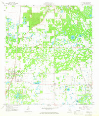
1958 Map of Bushnell
USGS Topo · Published 1966About this map
Bushnell serves as a primary hub for this 1950s interior Florida landscape, where the Seaboard Air Line and Atlantic Coast Line railroads dictate the layout of small settlements like Sumterville and Center Hill. The terrain is characterized by a complex network of wetlands and prairie lands, including Towns Prairie and Clark Prairie, alongside numerous family-named bodies of water such as Annie Marsh Pond and Mobley Pond. Significant local history is preserved in the location of the Evergreen Cem and the Mt Zion Ch north of Bevilles Corner. The map reveals a mid-century economy balancing agriculture and resource extraction, evidenced by various Quarries and a Sandpit near the rail lines, while the Jumper Creek Canal highlights the systematic drainage efforts that transformed the Sumter County wetlands for settlement and use.
Find a feature on this map
39 named features on this map. Tap any name to fly to it.
Don’t see what you’re looking for? This feature index may not catch every label — zoom into the map to look around manually.
Map Details
Editions of this 1958 Bushnell Map
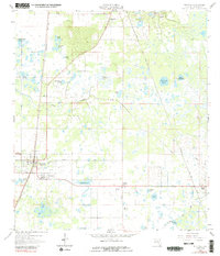
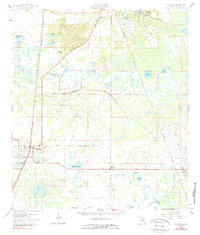
4 editions found
Other maps of this area

1893 · Panasoffkee
USGS Topo · 1:62,500

1895 · Panasoffkee
USGS Topo · 1:62,500

1955 · Plant City
USGS Topo · 1:250,000

1955 · Orlando
USGS Topo · 1:250,000

1957 · Orlando
USGS Topo · 1:250,000

1958 · Orlando
USGS Topo · 1:250,000

1958 · Plant City
USGS Topo · 1:250,000

1958 · Webster
USGS Topo · 1:24,000

1958 · Bushnell
USGS Topo · 1:24,000

1958 · Wahoo
USGS Topo · 1:24,000