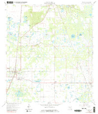
1958 Map of Bushnell
USGS Topo · Published 1989About this map
Bushnell serves as the focal point of this Central Florida survey, situated at the junction of the Seaboard Air Line and local routes like Nelson Road. The landscape is a complex network of wetlands and prairie lands, including Clark Prairie and Towns Prairie, punctuated by named water bodies such as Annie Marsh Pond and Mud Lake. The settlement pattern reveals distinct communities like Lincoln Park, Carver, and Sumterville to the north.
Find a feature on this map
38 named features on this map. Tap any name to fly to it.
Don’t see what you’re looking for? This feature index may not catch every label — zoom into the map to look around manually.
Map Details
Editions of this 1958 Bushnell Map
4 editions found
Other maps of this area

1893 · Panasoffkee
USGS Topo · 1:62,500

1895 · Panasoffkee
USGS Topo · 1:62,500

1955 · Plant City
USGS Topo · 1:250,000

1955 · Orlando
USGS Topo · 1:250,000

1957 · Orlando
USGS Topo · 1:250,000

1958 · Orlando
USGS Topo · 1:250,000

1958 · Plant City
USGS Topo · 1:250,000

1958 · Webster
USGS Topo · 1:24,000

1958 · Bushnell
USGS Topo · 1:24,000

1958 · Wahoo
USGS Topo · 1:24,000