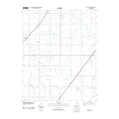
2010 Map of Bushyhead
USGS Topo · Published 2010About this map
The small community of Bushyhead sits at the intersection of local roads and rail lines, serving as a focal point for this rural landscape in Rogers County. The map reveals a deeply etched drainage system defined by Dog Creek, Pryor Creek, and Osage Creek, which wind through a grid of section-line roads like S 4240 Rd and E 390 Rd. These waterways and the small impoundments like Polone Reservoir dictate the movement and settlement patterns of the area, creating a patchwork of agricultural land and wooded corridors. For those exploring local family history, several prominent burial grounds are documented, including Lone Chapel Cemetery, Washington Cemetery, Dawes Cemetery, and Beck Cemetery. The presence of small, named localities such as Howard and Hisle further illustrates the dispersed nature of habitation across the plains, where the land is organized into a precise network of county routes and rural dwellings.
Find a feature on this map
48 named features on this map. Tap any name to fly to it.
Don’t see what you’re looking for? This feature index may not catch every label — zoom into the map to look around manually.
Map Details
Editions of this 2010 Bushyhead Map
This is the sole edition of this map. No revisions or reprints were ever made.
Other maps of this area

1896 · Pryor
USGS Topo · 1:125,000

1901 · Claremore
USGS Topo · 1:125,000

1901 · Nowata
USGS Topo · 1:125,000

1901 · Vinita
USGS Topo · 1:125,000

1901 · Pryor
USGS Topo · 1:125,000

1913 · Vinita
USGS Topo · 1:125,000

1914 · Nowata
USGS Topo · 1:125,000

1914 · Claremore
USGS Topo · 1:125,000

1916 · Claremore
USGS Topo · 1:125,000

1954 · Tulsa
USGS Topo · 1:250,000