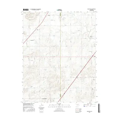
2016 Map of Bushyhead
USGS Topo · Published 2016About this map
Bushyhead and Hisle sit along the prominent transportation corridor in this Rogers County landscape, where the prairie begins to break into the drainage basins of Pryor Creek and Dog Cr. This modern survey reveals a region defined by its rural intersections and scattered local landmarks, including several historic burial grounds such as Beck Cem in the north and Washington Cem to the southwest. The terrain is marked by small-scale water management, evidenced by the 131010 Reservoir near Bushyhead and the Polone Reservoir further south. The map provides a clear picture of the grid-system road network, such as E 380 RD and E 440 RD, which connects the northern reaches of Claremore to neighboring settlements. To the east, the town of Adair marks the edge of the quadrangle near the crossing of Osage Cr, illustrating the continued importance of these small hubs in the northeastern Oklahoma countryside.
Find a feature on this map
49 named features on this map. Tap any name to fly to it.
Don’t see what you’re looking for? This feature index may not catch every label — zoom into the map to look around manually.
Map Details
Editions of this 2016 Bushyhead Map
This is the sole edition of this map. No revisions or reprints were ever made.
Other maps of this area

1896 · Pryor
USGS Topo · 1:125,000

1901 · Claremore
USGS Topo · 1:125,000

1901 · Nowata
USGS Topo · 1:125,000

1901 · Vinita
USGS Topo · 1:125,000

1901 · Pryor
USGS Topo · 1:125,000

1913 · Vinita
USGS Topo · 1:125,000

1914 · Nowata
USGS Topo · 1:125,000

1914 · Claremore
USGS Topo · 1:125,000

1916 · Claremore
USGS Topo · 1:125,000

1954 · Tulsa
USGS Topo · 1:250,000