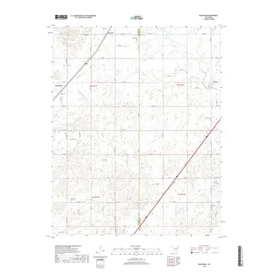
2019 Map of Bushyhead
USGS Topo · Published 2019About this map
Bushyhead sits within the undulating landscape of Rogers and Mayes Counties, where agricultural section roads and creek-cut valleys define the local geography. This survey provides a record of early 21st-century land use, highlighting rural settlements such as Howard and Hisle along with a series of community burial grounds. These include Beck Cem, Dawes Cem, and Washington Cem, which serve as vital markers for genealogical research in this part of Oklahoma. The drainage system is dominated by Pryor Creek and its various tributaries like Diver Cr and Little Pryor Cr, while man-made water features such as Polone Reservoir and 131010 Reservoir indicate managed water resources for the area. The landscape is characterized by a dense grid of rural roads, such as E 380 RD and E 410 RD, which connect the scattered homesteads and small farm-related hubs that persist in this region.
Find a feature on this map
68 named features on this map. Tap any name to fly to it.
Don’t see what you’re looking for? This feature index may not catch every label — zoom into the map to look around manually.
Map Details
Editions of this 2019 Bushyhead Map
This is the sole edition of this map. No revisions or reprints were ever made.
Other maps of this area

1896 · Pryor
USGS Topo · 1:125,000

1901 · Claremore
USGS Topo · 1:125,000

1901 · Nowata
USGS Topo · 1:125,000

1901 · Vinita
USGS Topo · 1:125,000

1901 · Pryor
USGS Topo · 1:125,000

1913 · Vinita
USGS Topo · 1:125,000

1914 · Nowata
USGS Topo · 1:125,000

1914 · Claremore
USGS Topo · 1:125,000

1916 · Claremore
USGS Topo · 1:125,000

1954 · Tulsa
USGS Topo · 1:250,000