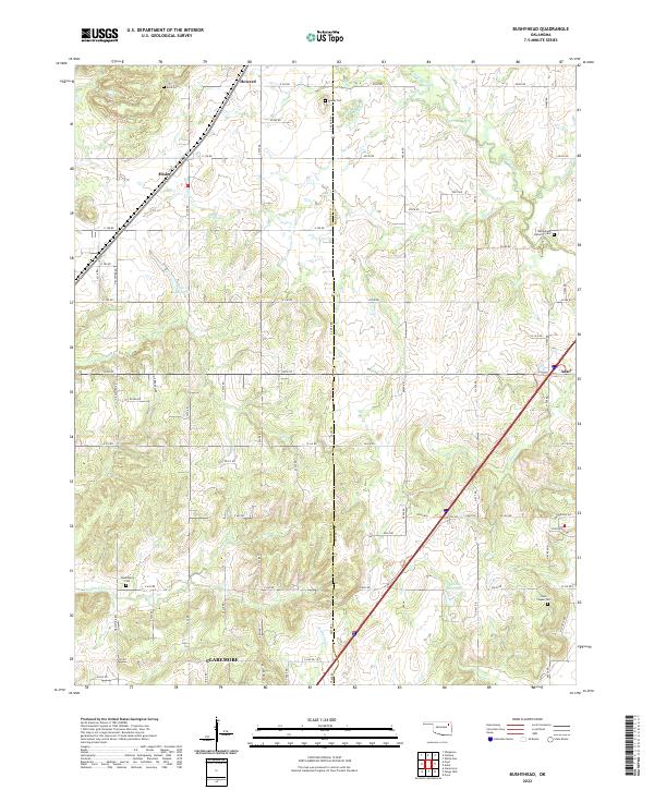
2022 Map of Bushyhead
USGS Topo · Published 2022About this map
Rogers and Mayes counties meet in this 2022 survey, where the rolling landscape is defined by the headwaters of several prominent regional waterways. The drainage divide between Dog Creek and Pryor Creek creates a complex network of small valleys occupied by Little Dog Creek, Diver Creek, and Seminole Creek. This terrain shaped the early rural settlement patterns, as evidenced by the distribution of family and community burial grounds across the township lines. Genealogists and local historians can locate Beck Cem and Dawes Cem in the northern sections, while Bethlehem Lutheran Cem and Lone Chapel Cem serve the eastern and southern vicinities. Smaller crossroads like Hisle and Howard appear as quiet landmarks against the more developed northern edge of Claremore and the community of Adair.
Find a feature on this map
53 named features on this map. Tap any name to fly to it.
Don’t see what you’re looking for? This feature index may not catch every label — zoom into the map to look around manually.
Map Details
Editions of this 2022 Bushyhead Map
This is the sole edition of this map. No revisions or reprints were ever made.
Other maps of this area

1896 · Pryor
USGS Topo · 1:125,000

1901 · Claremore
USGS Topo · 1:125,000

1901 · Nowata
USGS Topo · 1:125,000

1901 · Vinita
USGS Topo · 1:125,000

1901 · Pryor
USGS Topo · 1:125,000

1913 · Vinita
USGS Topo · 1:125,000

1914 · Nowata
USGS Topo · 1:125,000

1914 · Claremore
USGS Topo · 1:125,000

1916 · Claremore
USGS Topo · 1:125,000

1954 · Tulsa
USGS Topo · 1:250,000