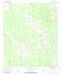
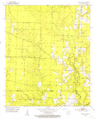
1960 Map of Bussey
USGS Topo · Published 1988About this map
The Kansas City Southern railroad cuts a north-south line through the western half of this Columbia County landscape, serving a region defined by its timbered bottoms and active petroleum industry. The Mc Kamie Patton Oil Field occupies the northwest corner, while numerous gravel pits and unnamed oil fields indicate the extraction-based economy of the 1960s. Rural life is anchored by small settlements and a high density of country churches and schools, including Woodard Sch and Friendship Ch.
Find a feature on this map
33 named features on this map. Tap any name to fly to it.
Don’t see what you’re looking for? This feature index may not catch every label — zoom into the map to look around manually.
Map Details
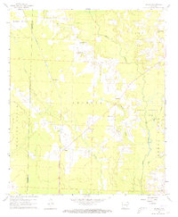
Editions of this 1960 Bussey Map
3 editions found
Other maps of this area
1952 · Bradley NE
USGS Topo · 1:24,000
1952 · Lewisville
USGS Topo · 1:24,000
1952 · Bradley SE
USGS Topo · 1:24,000

1953 · El Dorado
USGS Topo · 1:250,000

1957 · El Dorado
USGS Topo · 1:250,000

1958 · El Dorado
USGS Topo · 1:250,000

1960 · El Dorado
USGS Topo · 1:250,000
1960 · Bussey
USGS Topo · 1:24,000
1960 · Taylor
USGS Topo · 1:24,000
1960 · Walkerville
USGS Topo · 1:24,000