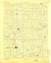
1894 Map of Butler
USGS Topo · Published 1905About this map
Butler and Rich Hill stand as the primary hubs of commerce and rail activity in this late-19th-century survey of the western Missouri prairie. The Missouri Pacific Railroad bisects the landscape, connecting these larger towns to smaller outposts like Adrian and Arthur. The southern portion of the territory is defined by the winding course of the Osage River, where historic river settlements such as Papinsville and Schell are situated near the border of Bates and St. Clair counties.
Find a feature on this map
94 named features on this map. Tap any name to fly to it.
Don’t see what you’re looking for? This feature index may not catch every label — zoom into the map to look around manually.
Map Details
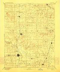
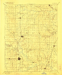
Editions of this 1894 Butler Map
4 editions found

Other maps of this area

1884 · Fort Scott
USGS Topo · 1:125,000

1885 · Warrensburg
USGS Topo · 1:125,000

1886 · Nevada
USGS Topo · 1:125,000

1886 · Stockton
USGS Topo · 1:125,000

1886 · Fort Scott
USGS Topo · 1:125,000

1887 · Clinton
USGS Topo · 1:125,000

1887 · Harrisonville
USGS Topo · 1:125,000

1887 · Olathe
USGS Topo · 1:125,000

1887 · Butler
USGS Topo · 1:125,000

1887 · Mound City
USGS Topo · 1:125,000