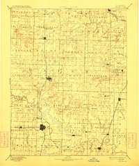
1894 Map of Butler
USGS Topo · Published 1912About this map
The Butler and Rich Hill hubs define this West-Central Missouri landscape during the late nineteenth century. As regional commerce centered on these growing rail junctions, the Missouri Pacific Railroad provided a vital north-south spine, connecting smaller agricultural settlements like Adrian and Archie. The drainage patterns of the Grand River and Osage River reveal a complex network of creeks that dictated early settlement boundaries, seen in the townships of Deepwater and Pleasant Gap.
Find a feature on this map
102 named features on this map. Tap any name to fly to it.
Don’t see what you’re looking for? This feature index may not catch every label — zoom into the map to look around manually.
Map Details
Editions of this 1894 Butler Map
4 editions found

Other maps of this area

1884 · Fort Scott
USGS Topo · 1:125,000

1885 · Warrensburg
USGS Topo · 1:125,000

1886 · Nevada
USGS Topo · 1:125,000

1886 · Stockton
USGS Topo · 1:125,000

1886 · Fort Scott
USGS Topo · 1:125,000

1887 · Clinton
USGS Topo · 1:125,000

1887 · Harrisonville
USGS Topo · 1:125,000

1887 · Olathe
USGS Topo · 1:125,000

1887 · Butler
USGS Topo · 1:125,000

1887 · Mound City
USGS Topo · 1:125,000